|
|
|
|
|
|
|
This page explains the nature and purpose of the Ibero-Mundo Atlas Team, affiliated with the Electronic Cultural Atlas Initiative (ECAI). Those interested in supporting this project should contact the team's editor, J. B. Owens, at owenjack@isu.edu.
|
Esta página muestra la naturaleza y el propósito del Equipo Atlas Ibero-Mundo afiliado a la Iniciativa Atlas Electrónico Cultural (ECAI). Los interesados en apoyar este proyecto deben contactar con el editor del equipo, J. B. Owens, en owenjack@isu.edu.
|
|
| |
THE IBERO-MUNDO ATLAS TEAM
|
EQUIPO DEL ATLAS IBERO-MUNDO
|
|
The Ibero-Mundo Atlas Team promotes data sharing and global collaboration in research and teaching, with a special emphasis on the world-wide domains of Iberian monarchies during the development of the first global age, from the late fourteenth to the early nineteenth century C.E. Between 1580 and 1640, most of these domains were consolidated into the huge composite political entity we often call the Hispanic Monarchy.
|
El Equipo Atlas Ibero-Mundo promueve la colaboración cooperativa en la investigación y la enseñanza con un énfasis especial en los dominios mundiales de las monarquías ibéricas durante el desarrollo de la primera globalización, desde las postrimerías del S. XIV hasta los comienzos de S. XIX, fundamentalmente desde 1580 hasta 1640, la mayoría de estos dominios se consolidaron dentro de la enorme entidad política que conocemos como Monarquía Hispánica.
|
|
In addition to the Iberian domains of the Crowns of Aragon, Castile, and Portugal, the Hispanic Monarchy included at various times significant parts of Europe (half of modern Italy, lots of modern eastern and southern France, the Low Countries ...), Atlantic island groups, all of Portuguese and Spanish America, enclaves in North, East and West Africa, large territories in Southern Africa (Angola and Mozambique), Portuguese municipalities throughout South and Southeast Asia, Macau, the Philippine Islands, and Castilian Oceanic holdings in the Pacific. Why take on so much within the context of a single atlas team?
|
Además de los dominios Ibéricos de la Corona de Aragón, de Castilla y de Portugal, la Monarquía Hispánica incluía, durante alguna época, partes significativas de Europa (la mitad de la Italia moderna, bastantes partes de la actual Francia del este y del sur, los Paíse Bajos, ...), grupos de islas del Atlántico, toda la América española y portuguesa, enclaves en Africa del norte, del este y del oeste, grandes territorios en sud Africa (Angola y Mozambique), las municipalidades portuguesas a lo largo del sur y del Sudeste Asiático, Macao, las Islas Filipinas y las posesiones oceánicas de Castilla en el Pacífico. ¿Porqué abarcar tanto espacio dentro de un sólo equipo de Atlas?
|
|
The Ibero-Mundo Atlas Team wishes to assist the transformation of the Humanities and Social Sciences and builds its innovative stance on two legs.
|
El Equipo Atlas Ibero-Mundo pretende ayudar en la transformación de las Humanidades y las Ciencias Sociales y construir sobre dos soportes su postura innovadora.
|
|
Where possible, History should be about CONNECTIONS, both geographic and thematic ones, and the work of an Ibero-Mundo Atlas Team overlaps and connects in interesting ways with that of other ECAI research groups. The global Hispanic Monarch can be characterized by a number of fairly similar economic, political, and religious institutions and practices. For example, when one reads about municipal government or episcopal administration in Toledo, Lisbon, Luanda, Goa, Melaka, Macau, Manila, Lima, Potosí, Mexico City, Baía, Palermo, or Milan, one moves through environments with many common elements. However, no adequate typology or feature list exists of these and other elements for this composite of territories. The world-wide scope of the Ibero-Mundo Atlas Team is important because to advance the understanding of world history, so necessary in our globalizing environment, scholars must think of their research as contributing to broader data sharing and intellectual collaboration rather than as specific, self-contained projects focusing on some discrete piece of the globe.
|
En lo posible, la Historia debe ser sobre CONEXIONES, tanto geográfica como temática y el trabajo de un Grupo de Atlas Ibero-Mundo debe solaparse y conectarse con el trabajo de otros grupos de investigación de ECAI. La Monarquía Histórica global puede caracterizarse por la existencia de numerosas instituciones y prácticas muy similares tanto políticas, como económicas como religiosas. Por ejemplo cuando se lee sobre Toledo, Lisboa, Luanda, Goa, Malaca, Macao, Manila, Lima, Potosí, Ciudad de México, Bahía, Palermo, o Milán nos movemos sobre un entorno con muchos elementos comunes. Sin embargo, no existe una tipologías adecuada ni lista de características de estos y otros elementos para este conjunto de territorios. El panorama mundial del Equipo del Atlas Ibero-Mundo es importante para avanzar en el conocimiento de la historia del mundo tan necesario en nuestro medioambiente de globalización. Los investigadores deben pensar en su investigación como contribuyentes en la mejora de la forma de compartir datos y la colaboración intelectual en vez de mirar sus proyectos como auto-contenedores que ponen el interés exclusivamente sobre alguna parte discreta del globo.
|
|
The Ibero-Mundo Atlas Team avoids the temptation to construct regional atlas teams so that they neatly divide up the world into conventional geographic areas, which do not overlap and are considered as the proper spatial containers for the data of all of human existence. It does so because the team feels that this form of organization will likely blunt, if not eliminate, the possibilities for the "connected" histories we want to write and teach. By maneuvering away from the organization of historical studies around modern nation-states or conventional area studies programs, we eschew any tendency to defend our spatial choices on the basis of long-term, essentialist civilizational and structural constants, which often conform to conventional geographical units of analysis, sometimes at the level of continents.
|
El Equipo del Atlas Ibero-Mundo evita la tentación de construir equipos de atlas regionales que claramente dividan el mundo en áreas geográficas convencionales, que no se solapen y que se consideren como redductos espaciales para los datos y toda la existencia humana. Y es así porque el equipo siente que esta forma de organización embotará, cuando no eleiminará, las posibilidades de las historias "conectadas" que queremos escribir y enseñar. Manteniéndonos alejados de esa forma de organizar los estudios históricos centrados en naciones-estados modernos o de programas de estudio convencionales, evitamos la tendencia de defender nuestras opciones espaciales sobre las bases de largo plazo, esencialidad de la civilización y constantes estructurales, que a menudo se conforman con las unidades geográficas convencionales de análisis, a veces a nivel de continentes.
|
|
Whatever limited functional utility nation-states and conventional geographic areas might have in gaining administrative recognition or grant funding, at the level of analysis, and especially at the level of comparison, scholars often reify the resulting spatial units as objective absolutes that can be understood on the basis of internal characteristics or positioned in some historical race to create other reified entities such as the "State" and "Capitalism", to become more "civilized", etc.
|
|
The development of the interactive economic, political, and information networks that bound together the increasingly global Hispanic Monarchy had such a profound impact on all of its parts that it is not possible to understand fully the history of any of its component regions without employing some sort of holistic global analysis. The Ibero-Mundo Atlas Team believes that research and teaching about world history can be successfully organized around regional atlas teams that do not run the risk of encouraging the deification of contemporary nation-states and area studies categories. We encourage by example the formation of atlas teams that question the autonomous histories of countries and regional entities, that force members to look and interact beyond their locations of specialization, and that demand collaboration among those who are experts on regions that were significantly connected over long historical periods.
|
El desarrollo de las redes interactivas económicas, políticas, e informativas que juntas limitaron la monarquía hispánica cada vez más global tuvo un impacto tan profundo en todas sus piezas que no es posible entender completamente la historia de cualesquiera de sus regiones componentes sin el empleo de una cierta clase de análisis global holístico. El equipo del atlas de Ibero-Mundo cree que la investigación y la enseñanza sobre historia del mundo se pueden plantear con éxito alrededor de los equipos regionales de atlas que no pretendan animar la deificación de las nación-estados contemporáneos y de las categorías de áreas de estudio. Animamos por ejemplo, a la formación de equipos de atlas que se cuestionen las historias autónomas de los países y de las entidades regionales, que fuercen a sus miembros a mirar y obrar recíprocamente más allá de su especialización, y que exijan la colaboración entre los expertos en regiones que estuvieron conectadas en largos períodos históricos.
|
|
On the basis of these principles, the Ibero-Mundo Atlas Team proposes to focus on the global domains of Iberian monarchies during the period 1350 and 1825, which roughly corresponds to the development of the first global age (we reject the term "early modern" because it is so obviously teleological and distorting). At various times during this period, these domains included significant areas of Europe and Castilian and Portuguese holdings in Africa, Asia, Pacific Oceania, and the Americas. The economic, administrative/institutional, and cultural networks and interactions that one would use to define this entity as a worthwhile geographical focus during this period provided a nexus for not only the circulation of Europeans but also of non-European officials and subjects of these Crown governments and of the connections of all of these individuals with locations outside these domains. Changes in the nature and scale of such human circulation and interaction are fundamental characteristics of the first global age, which in no way negate differences but are quickly lost through concentration on local or area specialties. |
En base a estos principios, el equipo del Atlas Ibero-Mundo propone centrarse en los dominios globales de las monarquías ibéricas durante el período 1350 y 1825, que corresponde más o menos al desarrollo de la primera edad global (rechazamos el término "edad moderna" porque ser tan claramente teológico y distorsionante). Durante este período, estos dominios incluyeron áreas significativas de Europa y de territorios castellanos y portugueses en África, Asia, Oceanía, y las Américas. Las interacciones, las redees económicas, las redees administrativo/institutionales, y las culturales que puedieron utilizarse para construir esta entidad como uno de los focos geográficos más importantes durante este período no sólo proporcionó un nexo para la circulación de europeos sino también de funcionarios y de sujetos no europeos pertenecientes a los gobiernos de esta Corona y de las conexiones de todos estos individuos con lugares fuera de esos dominios. Los cambios en la naturaleza y la escala de tal circulación e interacción humanas son las características fundamentales de la primera edad global, que de ninguna manera niegan las diferencias pero que llegan a perderse rápidamente por la concentración sobre determinados espacios o áreas.
|
|
The Ibero-Mundo Atlas Team´s official languages are Castilian, English, and Portuguese. Because of the global scope of the Ibero-Mundo region, the team expects that data will be published in other Iberian languages and in the many languages of world regions linked together by the Ibero-Mundo.
|
Las lenguas oficiales del Equipo del Atlas Ibero-Mundo son el castellano, el inglés y el portugués. Debido a la visión global de la región Ibero-Mundo, el equipo cuenta con que los datos sean publicados en otras lenguas ibéricas y en los muchos lenguajes de las regiones del mundo conectadas por medio del Ibero-Mundo.
|
|
Under the leadership of its Director of Cartographic Design, Miguel-Angel Bernabé of the Universidad Politécnica de Madrid, the Ibero-Mundo Atlas Team concentrates especially on producing high-quality cartographic representations of this global region, its constituent parts, and the connections among them. To assist the cartographic production of all ECAI atlas and thematic teams, Bernabé and Owens have published a "page of links about cartographic design".
|
Bajo la batuta de su Director de Diseño Cartográfico, Miguel-Angel Bernabé, de la Universidad Politécnica de Madrid, el Equipo del Atlas Ibero-Mundo se concentra fundamentalmente en la producciñón de representaciones cartográficas de gran calidad de esta región global, de sus partes constituyentes y de las conexiones entre ellas. Para ayudar en la producción cartográfica a todos los Atlas de ECAI y los mapas temáticos, Bernabé y Owens han publicado una "página de enlaces sobre el diseño cartográfico".
|
|
Because of its stress on the importance of interactions among locations, the Ibero-Mundo Atlas Team affiliates itself of the Old World Traditional Trade Routes (OWTRAD) Project of Matthew Ciolek of the Australian National University. Ciolek and Owens co-moderate the listserv ECAI-Routes as a forum for discussing Dromography, the study of geography, history and logistics of trade, movement, transportation and communication networks. The Ibero-Mundo Atlas Team now expands the listserv's focus to include the connections of the Americas and Pacific Oceania with Afroeurasia. On the OWTRAD page, Ciolek has published important papers on how data about routes should be noted.
|
Debido al interés sobre la importancia de las interacciones entre lugares, el Equipo del Atlas Ibero-Mundo se ha afiliado él mismo al Old World Traditional Trade Routes (OWTRAD) Project de Matthew Ciolek de la Australian National University. Ciolek y Owens co-moderan la lista ECAI-Routes cmo un foro para la discusión sobre la Dromografía, el etudio de la geografía, historia y logística del comercio, movimientos, transporte y redees de comunicación.El equipo Atlas Ibero-Mundo ahora expande el interés de la lista para incluir las conexiones entre las Américas, La Oceanía del Pacífico con Afroeurasia. En la página de OWTRAD, Ciolek ha publicado importantes trabajos sobre cómo deben anotarse los datos sobre las rutas.
|
|
Currently, the most advanced of the Ibero-Mundo Atlas Team's projects is the Spanish Shrines - Santuarios Españoles Project. The lead investigators are Ana Belén Barral and Mª Teresa Castejón Cay, with contributions from Owens and Bernabé.
|
Actualmente el más avanzado de los proyectos del Equipo Atlas Ibero-Mundo es el Proyecto de Santuarios Españoles. Los investigadores que llevan el peso son Ana Belén Barral y María Teresa Castejón Cay, con aportaciones de Owens y Bernabé.
|
|
Current Ibero-Mundo Atlas Team members are: |
Miembros actuales del Equipo del Atlas Ibero-Mundo: |
| |
References
| |
|
| |
|
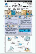
Julio 2001 XIX Congreso Internacional de la Historia de la Cartografía. Poster presentación (Adobe Acrobat) |
|
|
| |
|
|
|
URL: http://redgeomatica.rediris.es/ecai/atlas_iberomundo/atlas_iberomundo.html | |